The premier destination for premium listings. Submit Your Listing Now »

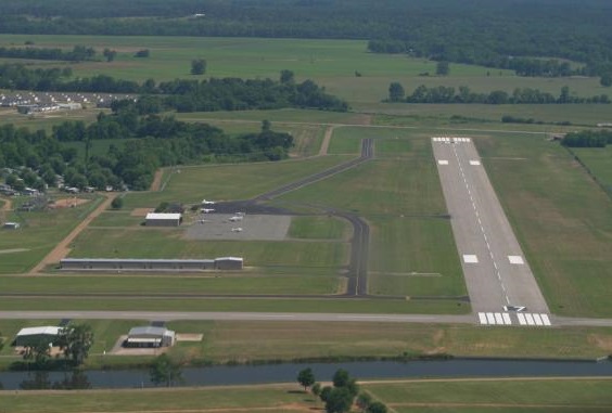
Natchitoches Regional Airport 0 5 0 0

Natchitoches Regional Airport

FAA: IER, Natchitoches, Louisiana - Elevation: 121ft.
  • 2777 Views
  • Sectional Chart: Houston
  • Pattern Altitude: 1100ft.

FREQUENCIES

CTAF: 122.8

Polk Approach: 132.05

DeRidder FSS: 122.15

AWOS: 119.025

GCO: 135.075
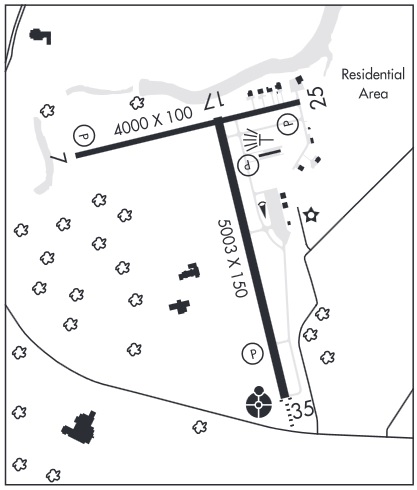
  • RUNWAYS:7/25 4000 x 100 ft. Asphalt. Lighted.

    17/35 5003 x 150 ft. Asphalt. Lighted.
  • SERVICES:City of Natchitoches. Tiedowns: free. Courtesy car, rental cars, pilot lounge, pilot supplies, flight planning, computerized weather.
  • PHONE:
  • WEB:

Contact Details

  • Address:
  • GPS:

Opening Times

Send To A Friend

Restricted airspace of Fort Polk nearby.
  • REMARKS:

Leave a Reply

Your email address will not be published. Required fields are marked *

You may use these HTML tags and attributes: <a href="" title=""> <abbr title=""> <acronym title=""> <b> <blockquote cite=""> <cite> <code> <del datetime=""> <em> <i> <q cite=""> <s> <strike> <strong>